PNW x Trial of Miles
- Meredith Renée

- Jul 31, 2024
- 9 min read
We started the trip with a super ambitious agenda of hiking which I soon found out did not include elevation or accession considerations.

Check out my photo essays from the week(s) of travel:
The Travel Itinerary:
Here are the National Parks and places we visited during our T&F off days. I’ve got to admit, it was rather ambitious, especially with hopping off the plane and straight into hiking.
First off, big thanks and appreciation to my travel companion and road warrior, Latrice. She did most of the pre-planning, selecting the parks to visit, fitting as much as we could into the 3-4 days we had to hike, and finding the best hotels (motels) to stay at in Washington and Oregon. If it had been up to me, we probably would have ended up sleeping in the back of the Traverse.
Honestly, I failed at the pre-planning portion of this trip. But I hope the photos make up for my faults, lol.
Day 1/// Arrival
Travel to Portland
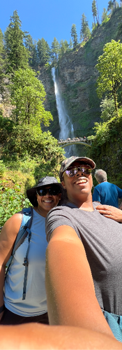
Visited and hiked Multnomah Falls
Drive to hotel near Mount Rainer
Day 2/// Mount Rainer
Mount Rainer National Park
Via the Skyline Trail – however we only went a mile up and a mile down due to the very snowy conditions
Traveled to Olympic National Park
Day 3/// Olympic National Park
Hoh Rainforest
Rialto Beach
Marymere Falls
Day 4/// Crater Lake National Park*
Crater Lake National Park
*We actually traveled to Eugene for a few days at US Track and Field Trials and some much needed recovery. Crater Lake was day 6 in our travel itinerary.
/// Day 1 – Straight from air to hike
After a full day of airplane travel that started with a 3:30am CST alarm, we finally arrived in Portland, OR around 1pm PST. We grabbed a few essentials from Target like water, snacks, and lunch. Then we set out to visit three waterfalls just outside of Portland. We made it to one.
Multnomah Falls
Elevation Gain/// 803 ft
Miles (Round Trip)/// 2.3 miles
Here's the thing: I wasn't prepared. This is a deceptively hard hike–All Trails list it as "moderate." But believe me, there's little time on this trail when you're not going up, up, up. I didn't know we were planning to go all the way to the top, but there I was, on a hike that I didn't have enough water, stamina, or energy for.
I love when you're on a trail and hikers passing by are smiling and telling you, "You're almost there!," "You're going to love it!," "Oh yes, it's definitely worth it." We didn't hear this once. I was a bit concerned. The gorgeousness of the falls is something you can view from the bottom, shoot, even from the highway passing by. The mile hike + 800 feet of elevation gain, I could have done without.
And don't get me started on that descent. It was easier to run down. I shouldn't sound so down on this hike. Maybe I would've like it better after a day a rest. Latrice loved it and for most of the trip she listed it as her favorite!
/// Day 2 – It get's better
We woke up at 4:00am on Day 2 to get an early start to Mount Rainer National Park. Staying overnight about 1.5hours from the park in city called Yelm. The city was small and the room was very comfortable at the Prairie Inn. Once we got to the park there was still about 30-45 minutes to drive to the Skyline Trail.
Mount Rainer National Park
Quick Tip: Get there early and get the timed entry pass.
Elevation Gain/// 1,700 feet (we gained 458 feet)
Miles (Round Trip)/// 5.7 miles (we did 2.0 miles)
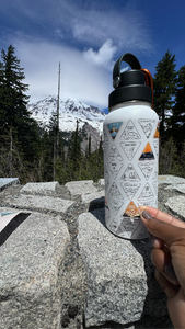
Once again, we were a little ambitious thinking we could make it to the Panoramo Viewpoin, which is at about 2miles turn around. We made it a mile up and decided to avoid tumbling back down the mountain and turned around at a still pretty nice overlook. Because it was a pretty clear day we could actually see all the way to Mount St. Helen.
I really enjoyed this hike, even though my hips were screaming at me later that day. I was basically skiing the whole way down to avoid slipping.

Please note: This trail is extremely snowy even in late June, like when we visited. Be prepared with trail shoes/boots and hiking sticks or be prepared to slip, slip, and slide. I was lucky enough to find a walking stick right at the beginning of the trail. I remembered while in Sedona folks would leave their walking stick at the end of their hike for the next hiker. I was appreciative of my "blessed" stick. I would have fell a couple of times without it. I go a nice lecture from a Park Ranger about my stick and not to take it with me (I wasn't planning to) but I understand he was just doing his job.
At the end of the trail I saw another group of girls who were very unprepared and they very happily and thankful took the stick for their journey up Mount Rainer.
///Day 3 – Olympic Park You Say

After driving to our second hotel of the trip, the Red Lion of Port Angelos we got a little later start on Day 3. Olympic National Park is HUGE! We really stayed on the outer 101 drive but I'm thinking this trip needs to happen again. Just so much to see.
Lake Crescent
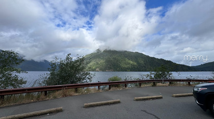
Simply beautiful! You get on the 101 heading west around the park and Lake Crescent just comes out as a surprise that smacks you in the face with it's beauty. I knew we were going to see some magical sights as soon as we took off.
We start driving and it's fog and rainbows. I wanted to pull over at every passing overlook section. And lucky us, we had no concrete plans so we did just that.
As we made our way around the lake you also start realizing the scope of the park. It's massive! It took an hour just to get around a part of Lake Crescent.
Along the way we also passed through Forks, Washington. Which apparently is a big deal to many Twilight fans. We stopped for a photo at the Red Truck and by the Welcome to Forks sign. Unfortunately, all of the werewolf and vampire references were lost on me.
Hoh Rainforest
We finally made it to the Hoh Rainforest, which is pretty cool considering it's the only rainforest in the continental US. And it actually rained, well misted pretty much the entire time we were there. When I tell you Olympic Park has it all!
I've heard some folks say the Hoh Rainforest was their favorite stop in Olympic Park. It's a "no" for me. I'm glad I experienced it but upon reading more I think it's something you can experience in other sections of the park with far less people. Actually, I'll go as far to say I might have enjoyed it more had it been less crowded.
Rialto Beach - It's La Push, baby
Another Twilight reference lost on me. But what was not lost was the beauty of Rialto Beach! I looked up cool hikes the night before, and this was my choice for our Olympic day. This place was pure magic! Which is appropriate, since a precocious 2-year-old cast a few spells on Latrice and me while in the Hoh Rainforest Visitor Center. His mother was very apologetic and shared with us that he seems to believe that he is Dumbledorf (another thing lost on me). And says she's gone as far as to have to "No Spell Casting Zones." Poor momma.
Rialto Beach to End of the Wall
Elevation Gain/// nothing really, I mean we did climb a wall that was maybe 30 feet
Miles (Round Trip)/// 3 miles (round trip)

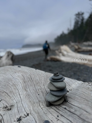
I can't stress how much I loved this place. I can see why folks literally were setting up camp on the shores. The waves crashing the surprise at the end was fun to me! I imagined it was like being on a Nickeloden game show Guts. As the tide was coming in closer and closer to the dry land we would take off running to not get caught by the waves. A few times I hopped on top of large trees like the one above. I had no idea I could still do that... lol. But look here, I wasn't going to get my shoes wet!
As we got to the end of the trail, I was ready to call it quits. The rocks were slippery and I was tired. But right at that moment a stranger popped out the woods and asked if we knew where we were headed. I was hesitant—we were pretty far from the rest of the hikers who had already turned around. He explained that if we climbed the hill, we'd see the most amazing view, and there's even a rope to help pull ourselves up.
I was beyond hesitant at this point. Antennas up. Nope. Nope. Nope.
But Latrice was 50/50 and really seemed like she wanted to give it a try. So I tugged on the rope, it felt secure. Eff it, why not! I'm happy we did.
DO YOU SEE THIS!! My God it was beautiful.
You can see all the way up the beach to the north from this vantage point and climb down. However, because of the rising tide, we decided to head back. Shoutout to that random guy who gave us this tip—I would have never found it on my own.
And there's more–Marymere Falls
We had a full day at this point but I just HAD to stop at the Marymere falls. Get it?
Marymere Falls Trail
Elevation Gain/// 80ish feet
Miles (Round Trip)/// 2 miles (round trip)
EASY except for the last 80 feet that's all up hill.

The hike was overall easy. And as I mentioned earlier about Hoh Rainforest, it reminded me a lot of the Rainforest. However, a lot less crowded and just as pretty. If we had a lot more time and endurance the hike attached to this Kings Trail sounds like a real challenge and I'd love to do next time I travel out there. My favorite part was the view of a part of Lake Crescent. I literally could've sat there all day.
Side Note: While at Rialto Beach we met the funniest group. They asked about the beach and we gave them all the details about climbing the wall. As they walked away the guy in the group declared "I'm feeling that sassy today!" about going all the way down the beach. We laughed and laughed. Funny enough we ran into the group after dinner and learned they were from Louisiana.
I just love that about hiking.
Get ready for "Feeling Sassy might go for a hike" Shirt.
/// Day 4–Last National Park for this trip
Crater Lake National Park
Elevation Gain/// 272 feet
Miles (Round Trip)/// 2 miles (round trip)
EASY

I was not feeling great this day and hiking was the last place in the world I wanted to be. However, Crater Lake is just so awe-inspiring. There were so many times I had to take off my sunglasses, look out, look at my phone again and make sure I didn't have a filter on. The colors were so vibrant! The Blue was so BLUE! Crater Lake is one of the deepest and clearest lakes in the world. You can easily see how!
There still was a little bit of snow on the trails and only about 1 mile of the Crater Lake Drive that goes around the whole lake was open to cars. The hike was relatively easy and not too steep. At above 7000 feet above sea level, the temperatures were low as well and it was a bit windy. The Park Rangers explained that although the drive was not open to cars, hikers could take the road or trail around the lake. We only went about a mile out and turned around. I took the road back, to take it a little easier on my body.
Whew!!! We made it.
/// Here are a few tips:
Don't be like me–Plan ahead!
Check the trails for the days you will be there. There's still a lot of snow in June and apparently in early July.
Have some good hiking shoes or boots. We both wore hiking shoes and they were fine. But I can definitely see why boots would be necessary on hikes like Crater Lake and Mount Rainer.
There are not a lot of places to stay in Port Angelos. Book early.
Mount Rainer:
The hotel in Mount Rainer is so cute! If you've got it, stay there in the park. But you've got to book it early.
Get your timed entry early. We drove right into the park with no traffic at 7:30am. When we left around 1pm there was a line at least 2 miles long!
Bring walking sticks if you're there before the end of July.
Boots. The snow is pretty deep. I got out without getting my ankles wet but I saw a lot of folks who were not so lucky.
Get your National Park Pass. It's like $85 and give you access to all the parks. Otherwise you have to pay at each park and that can be anywhere from $25-$40 for entry.

This is a long one. I think I'm done for now. Let me know if you've got questions!!!


Comments